A series of winter storms will continue moving through the region through Thursday, bringing the greatest impacts to local mountain communities, including the San Bernardino Mountains and Riverside County Mountains. National Weather Service forecasters warn that heavy snow, damaging winds, and periods of moderate rain could create difficult travel conditions and possible roadway closures, particularly at higher elevations.
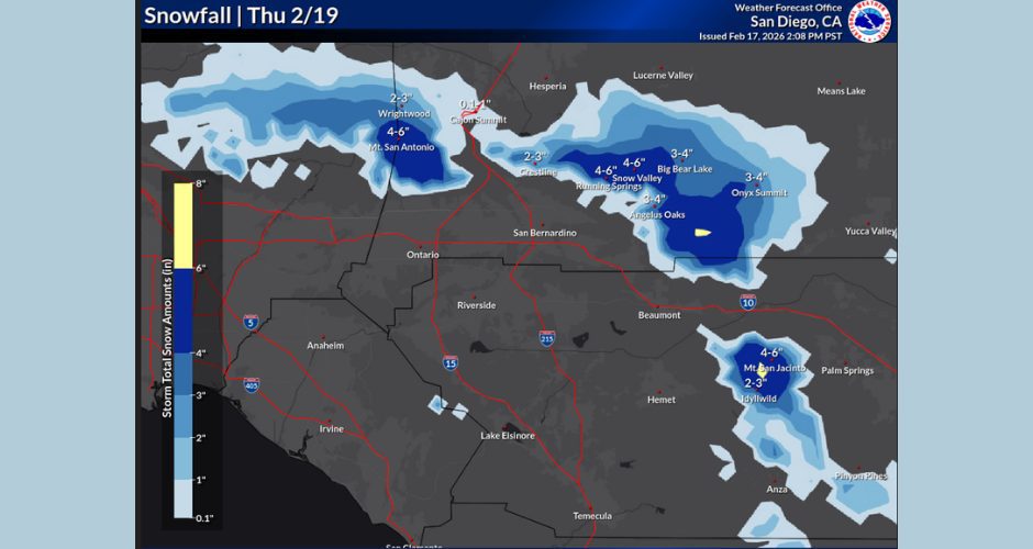
Winter Storm Warnings remain in effect through Thursday, with snow levels hovering near 5,000–5,500 feet tonight before dropping to around 3,500–4,000 feet by late Wednesday morning. Forecast totals call for 6–12 inches of snow between 5,000 and 6,000 feet, 12–20 inches between 6,000 and 7,000 feet, and locally more than two feet above 7,000 feet, with additional snowfall expected Thursday. Forecasters note that snowfall rates could reach up to three inches per hour at times, especially in the Big Bear area, creating periods of extremely low visibility.
Strong winds will accompany the storm system, with mountain gusts reaching 50–65 mph and locally up to 75 mph along desert-facing slopes and passes. These winds may lead to blowing snow, reduced visibility, and hazardous driving conditions for high-profile vehicles. Residents and visitors are urged to use caution, avoid unnecessary travel during peak storm periods, and monitor conditions before heading into mountain areas.
Rainfall across lower elevations is expected through Thursday, with occasional heavier bands Wednesday morning and again Thursday afternoon. While most of the weekend is expected to be dry, travelers should remain alert for lingering impacts and changing road conditions as cleanup and snow removal continues.